
Tuesday, June 10, 2008
Chinese Landslide Dam Failure Flood in Action
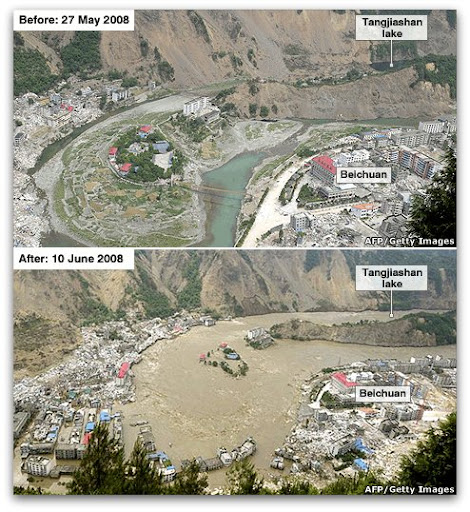 This photo pair is interesting. Amazing how close the community is to the landslide dam...it so easily could have been partly buried by the landslide...but in that case, maybe the valley could not have been dammed so easily. Moot, obviously.
Monday, June 9, 2008
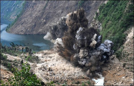
Landslide Dam Failure in China

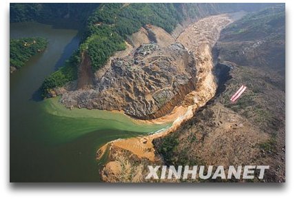
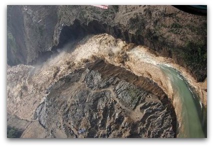 The significance of these photos to the average Yeehow is quite clear. The principal landslide dam following the recent major earthquake in China has failed. These photos show the breach and the incredibly cool draw-down tongue. For some cogent discussion about this event, check out the blog of Dr. David Petley at which I found the bottom two images and a lot of commentary: http://daveslandslideblog.blogspot.com/
Tuesday, June 3, 2008
Damming Ruminations by Brother Spud
Hi Folks,
Here are the figures from my thesis that relate to the last post I made on friday night. I hope they help you visualize some of what I described.
-Spud
 Figure 2. Exposure of the Saddle Butte lava near Read-it-and-Weep rapid (river kilometer 34.25). Exposure shows foreset beds of hyaloclastite and lava pillows, the passage zone, and subaerial lava. The foreset beds of pillow lavas and hyaloclastite dip down to the right, indicating that the lava advanced from left to right into a body of standing water. Much of the hyaloclastite has altered to orange-colored palagonite. The passage zone marks the elevation of the water surface. Above the passage zone, subaerial lava was emplaced. Exposure is ~60 m thick.
Figure 15. Aerial photograph of river kilometers 37.5–39.5 showing presumed initial location of West Crater lava dam. The

Figure 16. Photograph of outcrop relations at river kilometer 39.25. The Saddle Butte lava appears to underlie the sediment lens in the center of the photograph. The head of the West Crater lava dam overlies the sediment lens and the Saddle Butte lava. Foreset beds of pillow lavas and hyaloclastite dip down to the right in this image. Several different passage zones (indicated by PZ) indicate the lake level rose during construction of the dam. The location of the paleovalley wall discussed in Figure 15 is indicated by a dashed ellipse. The lens of sediment interpreted to be paleo-Ryegrass Creek is visible in the center of the photograph.
Subscribe to:
Posts (Atom)