Friday, June 26, 2009

Fresh New Insights from the LiDAR

Hey y'all. I spent three days at the AASG Annual meeting in Park City, UT this week. Gave a presentation in front of approx 30 versions of my boss about 'Simple Digital Geology for Typical Analog Geologists'...went very well and was a lot of fun. Had a chance to talk with Ian Madin of DOGAMI about LiDAR visualization. In 2 seconds he convinced me that using a combination of slope shading and elevation color ramping produces the best results in almost every setting. I do recall that, on our last trip, Natalia asked me why I didn't use this method on the maps I handed out. Good question. Now I do.

Here are some images of a familiar area:


The slope-shading method looks a bit less 'real' but provides an amazing enhancement of slope contrasts that reflect important contact relations. Try it out on the data yourself and you will be amazed at the new array of relations that will jump out at you. For example, look at the young landslide nested in a larger slide along the Saddle Butte lava flow in the lower left corner. Pretty obvious now, no? Probably blocked the channel. During field camp, I found one of these in the Artillery Rim complex that is nested in the older slide complex. It too flanks a notably narrow reach of the river and may be associated with a young blockage.

Yes. Some additional map details will be added soon.

Also, while at the meeting I spoke with Vicki McConnell (State Geologist of Oregon) about publishing the map. She is all for it as long as I (we) can help defray the cost of production. I suspect the NSF grant can help cover this. I will do the lion's share of the work, so shouldn't be too much.

Wednesday, June 17, 2009

West Crater-Dogleg area looking good.

Mapping update. Things are cranking along. Still have some aberrant unattributed polys...

Monday, June 15, 2009

The Penultimate List of Map Units

It is crunch time on the map. I have so many other maps to work on that I need to begin seriously riding the asymptote to the completion of this one. After many years of solo and collective field observations and various consultations, arguments, and friendly exchanges with most of the Yeehows, I have settled on this list. If you have grave concerns please, please, oh please let me know sooner rather than later. I will throw the correlation diagram up soon.


Hillslope Deposits

Qcf Undivided colluvium and alluvial fan deposits, Holocene to Pleistocene

Qc Colluvium, undivided, Holocene to Pleistocene


Eolian Deposits

Qe Eolian sediments, Holocene to late Pleistocene(?)


Deposits of the Owyhee River

Qra Active channel and floodplain alluvium, Recent to late Holocene

Qry Young fluvial sediments, Holocene

Qrty Young floodplain terraces, Holocene

Qrt1-n Fluvial terrace gravels, Pleistocene (numbered in local depositional order where appropriate)

Qrg Fluvial gravel, undivided, Pleistocene

Qgb Fluvial boulder bars, Pleistocene

Qgw Fluvial gravel of West Crater lava, late Pleistocene

Qrgo Older fluvial gravel, Pleistocene

Qgbr Fluvial gravels of Bogus Rim lava, early Pleistocene

QTgl Ancient, inter-lava flow fluvial gravel, early Pleistocene to Pliocene

QTga Fluvial gravel of Artillery rim, early Pleistocene to Pliocene(?)


Lacustrine deposits of the Owyhee River corridor

Qfl Fluvio-lacustrine sediments, undivided, late Pleistocene

Qflw Fluvio-lacustrine sediments of West Crater lava dam, late Pleistocene

Qfls Fluvio-lacustrine sediments of Saddle Butte lava dam, late Pleistocene

QTfa Fluvio-lacustrine sediments of Artillery Rim, early Pleistocene to Pliocene


Landslide Deposits

Qls Landslide deposits, undivided, Holocene to early(?) Pleistocene

Qlsy Young landslide deposits, Holocene to late Pleistocene

Qlsby Young landslide deposits composed dominantly of coarse basalt breccia, Holocene to late Pleistocene

Qlsi Intermediate age landslide deposits, late Pleistocene

Qlso Old landslide deposits, middle to early (?) Pleistocene


Alluvium of Owyhee River tributaries and local drainages

Qa Alluvium of tributary washes and alluvial fans, undivided, Holocene to Pleistocene

Qas Alluvium and related sediments of active springs, Holocene to late Pleistocene

Qad Alluvium of closed depressions and sags, Holocene to late Pleistocene

Qay Young alluvium of tributary washes and alluvial fans, Recent to Holocene

Qai Intermediate age alluvium of tributary washes and alluvial fans, late Pleistocene

Qao Old alluvium of tributary washes and alluvial fans, middle to early Pleistocene

QTa Ancient alluvium of tributary washes and alluvial fans, early Pleistocene to Pliocene


Basalt lavas of the Owyhee River corridor and surrounding areas

Qbcp Basalt of Coffee Pot Crater, Holocene*

Qbrb Basalt of Rocky Butte, Holocene (?) to late Pleistocene*

Qbw Basalt of West Crater, Pleistocene

Qbs Basalt of Saddle Butte

Qbsy Younger basalt of Saddle Butte

Qbso Older basalt of Saddle Butte

Qbc Basalt of Clarks Butte

Qbg Basalt of Greely bar, early Pleistocene

Qbr Basalt of Bogus Rim, early Pleistocene

QTbc Basalt of Bogus cliffs, early Pleistocene to Pliocene

QTb Basalt, undivided, early Pleistocene to Pliocene

Tb Undivided basalt lavas, Pliocene to Miocene (?)

Tbs Undivided basalt lavas and interbedded sediments, Miocene to Pliocene

*These lavas only on regional map, not in river corridor


Rhyolite lavas and sedimentary rocks

Tsv Interbedded volcanic, volcaniclastic, and other sedimentary rocks, Miocene

Tr Undifferentiated rhyolite lavas, Miocene

Page size map in progress...really.

Sure, I have made one of these before, but now we are closing in on the penultimate representation. My life can only afford two more trips into the field this summer and fall. Next comes the simplified explanation.

Friday, June 12, 2009

Desecration or Inspiration? You decide.


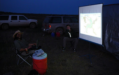
A new digital experience on the rim of the Owyhee Canyon. Turns out, it was a brilliant idea. You would love to see the LiDAR this large. It was a great way to review the day's transect and show pictures of stuff the students didn't get to see on the foreshortened tour of the muddy field area. Good plan for a formal field trip. Trust me, it works.

Sorry Yeehows, Our Secret is Out

The hydrograph above effectively encapsulates the ambient conditions of field camp. The overall wetness was pretty freaking shocking.

The field camp experiment is over. It was a muddy success. The region was (and still may be) under the influence of a persistent cutoff low pressure system that delivered record amounts of rainfall. It is true that the roads on the rim become somewhat challenging when they get wet, but we did manage to get seven vehicles all the way in and out to the Artillery Rim camp site (eventually). The first night at Rome launch, it rained nearly 1.5 inches. A record for Rome. It was truly disheartening. While lamenting my plight at the Rome Cafe very early on Saturday, the woman in charge at the time offered up access to the Grange building in Arock for us to use while we waited out the rain. Once in Arock, we were given access to the Arock School by an extremely gracious host. The school was a perfect fit for us...hot water, bathrooms, class rooms with high-speed internet, a playground, etc.

While at the school waiting out the rain, I gave a marathon lecture (with playground breaks) about the study area, the Quaternary, surficial geologic mapping, and of course provided various demonstrations about geotagging photos, how the gigapan robot works, how I make a map in ArcGIS, and how the magic pen works.

Thankfully, Duane and Caitlin were also there. Duane gave a lecture about the history of paleomagnetism and described how it works in the case of correlating basalt units in the field area.


Caitlin gave a lecture about her project. That night it rained like hell and we enjoyed watching a major thunderstorm plow through Arock. All the more enjoyable because we had a dry place to sleep.

The next day, we had a foreshortened tour of the field area (mud concerns) and made it to the Coffee Pot lava field and the vent by way of the Rockhouse Coffee Shop...all great places to take students.


The road to Birch Creek was in good shape so we peered over the rim. The students were moderately amazed because all they had seen of the river so far was the boring reach at Rome. We then headed out through JV and actually made it to Artillery Rim with only minor mud delays.

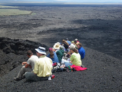
Once at the camp site, we approached the rim on foot as a group, and it was the perfect field camp moment. Everyone was awestruck by the view from there.


What then ensued were two perfect field days in the Artillery Rim landslide complex...full of ticks and snakes (lots of snakes), but the weather was perfect. The students had never faced such a complex array of landforms and deposits. Rest assured they have newfound respect for rivers, canyons, and Quaternary geology (and rattlesnakes).

The field camp mascot...saw 9 or 10 rattlesnakes in two days.

Here's an idea. Bring the girls from the Mackay School of Mines Mining Team into the field to dig for you. Next year, the augering competition. In less than 15 minutes they created the best exposure of the Qfl that any of us has ever seen.

The last day ended with an all night soaking rain, and we (the TAs, the cook, and I) were concerned that we may be stuck for a day. It was extremely wet that morning. But, alas, Duane (who proved various times on the trip that his last name is no fluke) and his field assistant Nicole showed up at our camp around 8 AM proving that the roads were viable. As we then rapidly started to take the camp down, it started to rain very hard and things were horribly wet. As we pulled out of the camp, there was a lot of water running down the rocky road past the gate. The rim roads were muddy as hell in the immediate area and one van got mired. It was a relatively easy extraction and we were again on our way through the mud. As we approached the (once-named) veneers of dreaded rim gravel, we changed the name to the sanctified rim gravel. The roads were fine and we proceeded out of the field with no incident.

Looks like my UNR field camp session will hit the Owyhee every year. It remains an amazing place worthy of sharing.

A beautiful evening looking north over the Artillery Rim landslide complex. Worth the trip.

Tuesday, June 2, 2009

Trip re-cap: The Boulders

This year's group trip to the Owyhee was a great success. I, with much help from everyone, filled in some gaps in the map and the stratigraphy; we all found some new stuff; explored some new areas; acquired valuable field data; and met some very cool people. I am madly compiling the gigpans I took and just remembered that I needed to reduce the GPS data for the boulder measurements. Just got that done. Here are some screen shots:

Bunny's Bar:

Artillery bar:


Look at each and note the very high correspondence between the two types of data--LiDAR and High-Precision GPS. It is a whole new world. Don't fall off.